
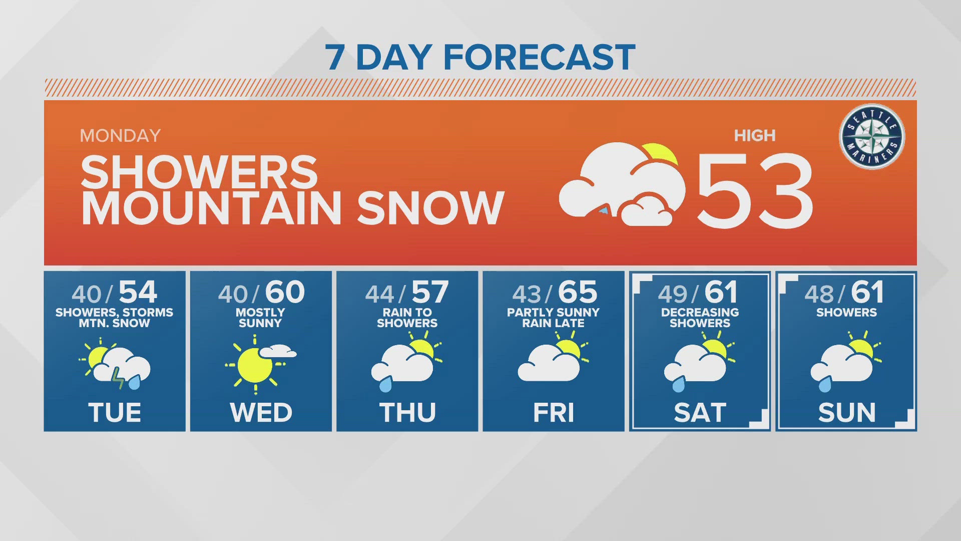
SEATTLE — Puget Sound Extended Forecast
Monday: Decreasing showers with afternoon sunbreaks. High temperatures in the low to mid-50s. 2-6 inches of new snow today above 4,000 feet.
Tuesday: Morning showers, especially south Sound becoming partly sunny during the afternoon. Morning lows around 40 degrees. High temperatures in the mid-50s.
Wednesday: Mostly sunny and warmer. Morning lows around 40 degrees. Highs in the upper 50s to lower 60s.
Thursday: Steady rain early changing to showers during the morning - decreasing in the afternoon. Morning lows in low to mid-40s. Highs in the mid to upper 50s.
Friday: Partly sunny with increasing rain later in the day. Morning lows in low to mid-40s. Highs in the mid-60s.
Saturday: Decreasing showers with afternoon sunbreaks. Morning lows in the mid to upper 40s. High temperature in the low to mid-60s.
Sunday: Partly sunny with slight chance of a shower. Morning lows in the mid 40s. Highs in the low to mid 60s.
Discussion:
While April is ending on a wet note, it doesn't look like it will salvage the incredibly dry month. April rain totals at Sea-Tac should surpass three inches but will be lucky if we can squeeze out enough to hit one inch of rain for the month. April rain totals have totaled less than an inch just seven times in recorded history.
Cooler air is knocking snow levels down to around 2,000 feet by Monday morning, but accumulations will be tricky below about 3,000 feet because of warmer surface temperatures. This means Snoqualmie Pass likely won't see more than an inch or two. However, through Monday late morning, a fresh 4-6 inches of beneficial snow looks likely above 3,500 feet for the Cascades, with up to 8" possible for highest elevations.
Monday will feature more sunbreaks compared to Sunday, but instability is prompting thunderstorm risk. Minor thunderstorms are possible for most of Western Washington, including in the mountains. Storms may produce thunder/lightning, gusty wind, small hail, plus brief periods of moderate to even heavy rainfall.
Another disturbance brushes by from the northwest early Tuesday morning, bringing pockets of stronger rain in the early morning hours, mostly down south.
Wednesday is now trending toward brief drying and warming, with sunshine and low 60s returning for just one day. Thursday, light showers return.
The weekend is not clear right now. Some models are leaning toward cool, wet weather in the mid 50s, while others are hinting at 70s possible. At this point, with that much disagreement, we'll meet in the middle and shoot toward low 60s with scattered showers for next weekend.