
SEATTLE — Puget Sound Extended Forecast
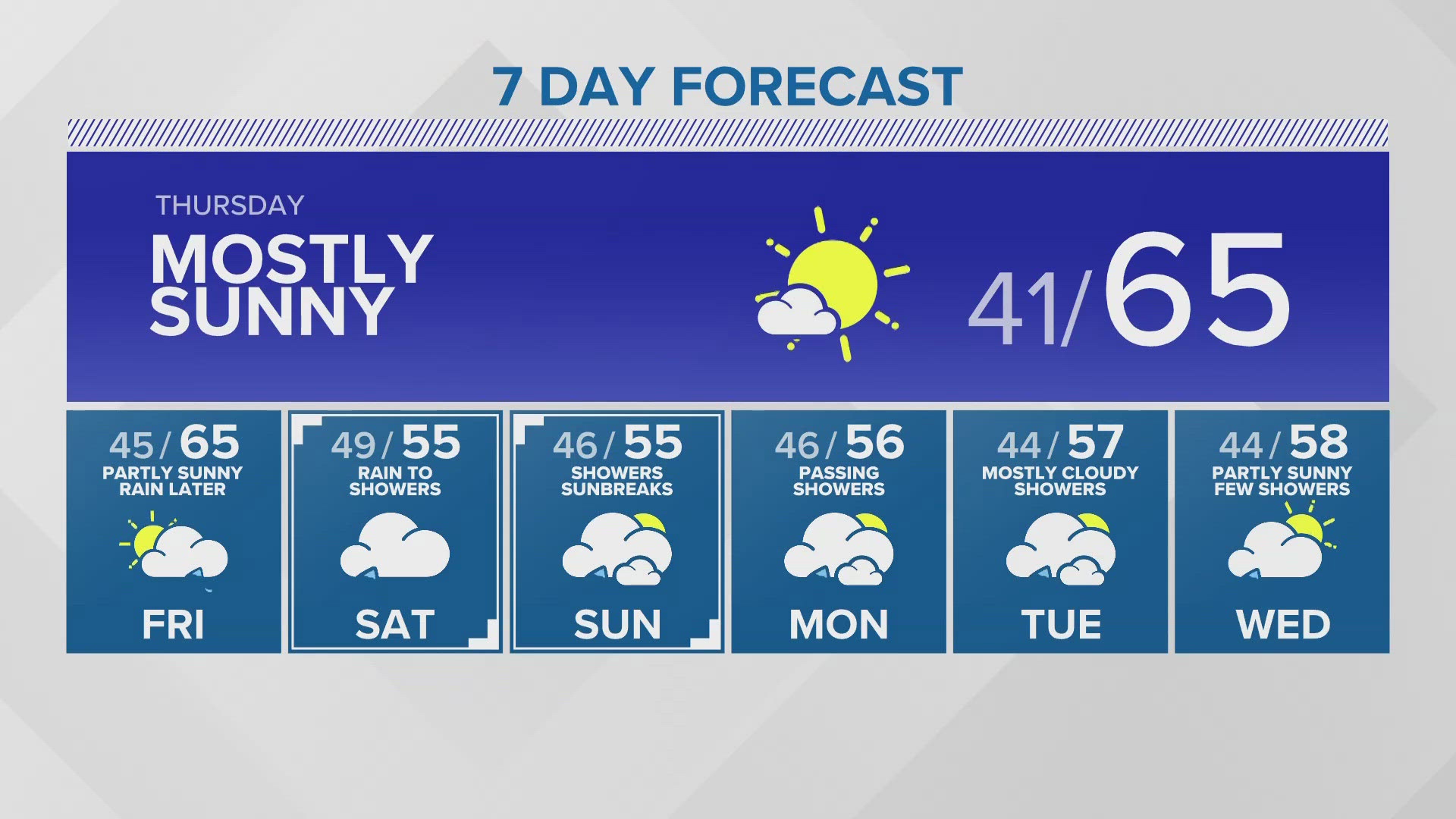
Thursday: Early morning frost and patchy fog for some. Mostly sunny and warmer. Morning lows around 40. Highs in the low to mid-60s.
Friday: Clouds build throughout the morning and afternoon. Increasing chance of rain late afternoon or evening. Morning lows in low to mid-40s. Highs in the mid-60s.
Saturday: Morning rain changing to off-and-on showers. Morning lows in the mid to upper 40s. High temperature in the low to mid-60s.
Sunday-Monday: Chance of showers mixed with sunbreaks. Morning lows in the mid-40s. Highs in the low to mid-60s.
Tuesday: Mostly cloudy with passing showers. Lows in the low to mid 40s. Highs in the mid 50s.
Wednesday: Partly sunny with a few showers. Lows in the low to mid 40s. Highs in the mid and upper 50s.
Discussion:
A weak front will clip the southwest part of the state tonight, which will increase the chance for light showers, mainly for the Southwest Interior / coast. Clouds will increase into Puget Sound, as well. The front will pass to our south and it will take its rain into Oregon overnight and skies will clear by Thursday morning.
High pressure will move through the state later Thursday into Friday for sunshine and highs in the low to mid 60s. A warm front will spread rain into Washington from southwest to northeast on Friday. Rain should begin to move into Puget Sound by the afternoon / evening - this is the start of a cool and damp weekend in Western Washington.
Saturday will start wet but change to off-and-on showers mixed with sunbreaks later in the day and those should continue Sunday through Tuesday.
Look for a little drying and warming around midweek next week.